|
|
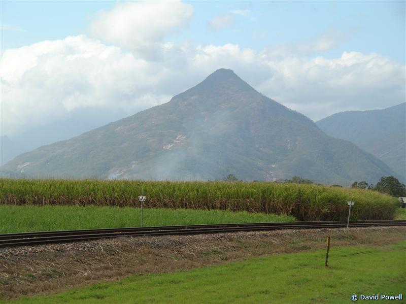
Walshs Pyramid, near Gordonvale
Image © David Powell, 2007
|
|
|
|
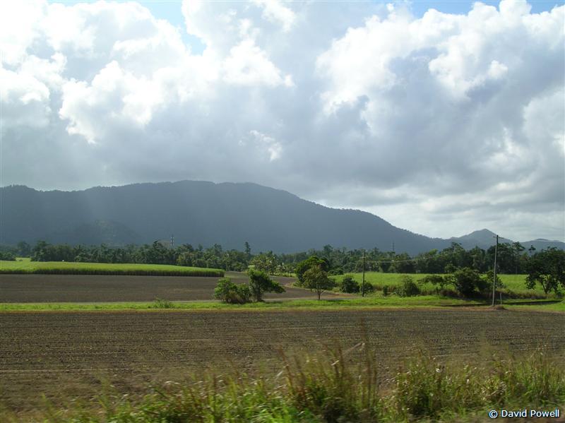
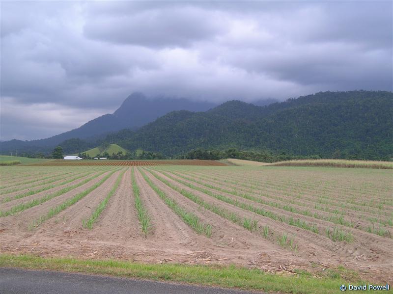
Canefields & Russell River
National Park, near Deeral
Image © David Powell, 2007
|
|
Day 3
Headed down south of Cairn's for the day's activities, centered around
the town of Innisfail. Drove thru' Cairns .. the city is an evolving
mix of old and new. Until the mid 90's it was just another poor,
struggling tropical town, living on the back of the sugar industry and
a handful of "beach bum" style tourists, living cheap as they traveled
around the country .. there pretty much just for the beaches. As an
aside there's little or no surfing on the far north coast - the coral
reefs kill the force of the waves and even on a good day, what reaches
the coast is far
|
|
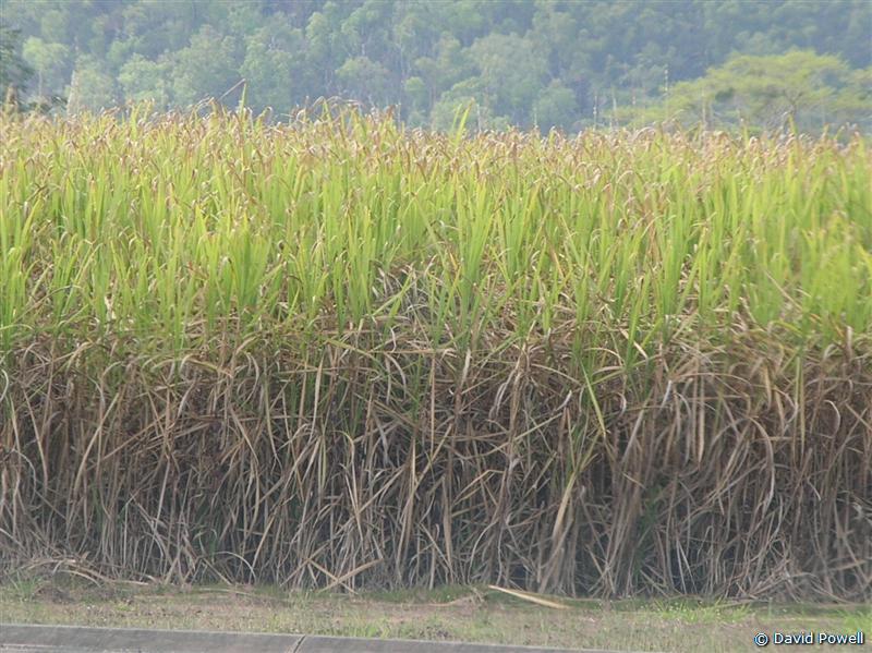
Sugar cane, near Gordonvale
Image © David Powell, 2007
|
|
|
|
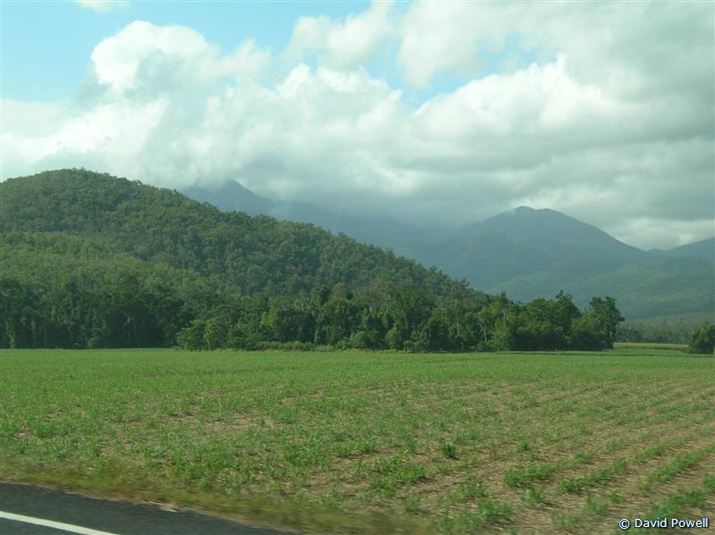
Cane & Wooroonooran Nat. Park
Image © David Powell, 2007
|
|
too tame for the surfing. But there're the beaches and
that's another matter for beach fans. But with the development of Port
Douglas as a resort mecca (more on that another day), tourism in Cairns
got a kick start and its development took off, helped by having the
region's international airport. The poorer, old look is being steadily
replaced by the newer glitzy and monied look. Resorts replacing $40 a
night hostels. Rydges, Hilton and the like. The result is an uneasy mix
between the down to earth sugar industry (Cairns is one of the main
sugar ports) and the upmarket tourism industry. Other towns in the
region have gone all one way or the other, but Cairns remains a
balancing act between the two. Time and money will tell which way it'll
go in the future.
Anyway, enuf on Cairns, we just drove thru' it after all. Heading on
south thru' the cane fields. Lots and lots of cane fields - most fairly
small patches. Cane growing seems to be largely a small family farm
affair in the region. Some plots were barely larger than the
traditional (and now almost extinct) city 1/4 acre housing block. Just
south of Gordonvale we passed an extinct volcano, Walsh's Pyramid. Of
course, the whole Great Dividing Range was peppered with volcanoes once
upon a time .. all long extinct and most so far weathered to be
unrecognisable except by a geologist. But there're a few that went
extinct a bit more recently than the rest. Walsh's Pyramid, at 922
metres, is the largest pyramid in the world, natural or artificial.
More cane fields, mixed with banana plantations. Bananas are the other
main crop of the region, tho' they grow many different sorts of
tropical fruits as well.
Innisfail. Just drove thru'. Definitely a working farm town. Little or
no sign catering to tourism or tourist dollars here. The tourist centre
is faded, small and dusty. Most of the sight-seeing spots are outside
the town. Just south of Innisfail we got the first rain of the trip.
Not too unsurprising - today was the first day of the wet season. Only
a brief shower but a foretaste of things to come, no doubt. Here the
wet season means the possibility of a metre of rain in one day (on a
bad day, mind you) and rain pretty much every day - the post card
pictures of people lazing on tropical beaches are usually taken in
winter - when it's hot and dry. Summer is hot and wet. Not surprising,
the tourist season here is from March to October.
|
|
|
|
|
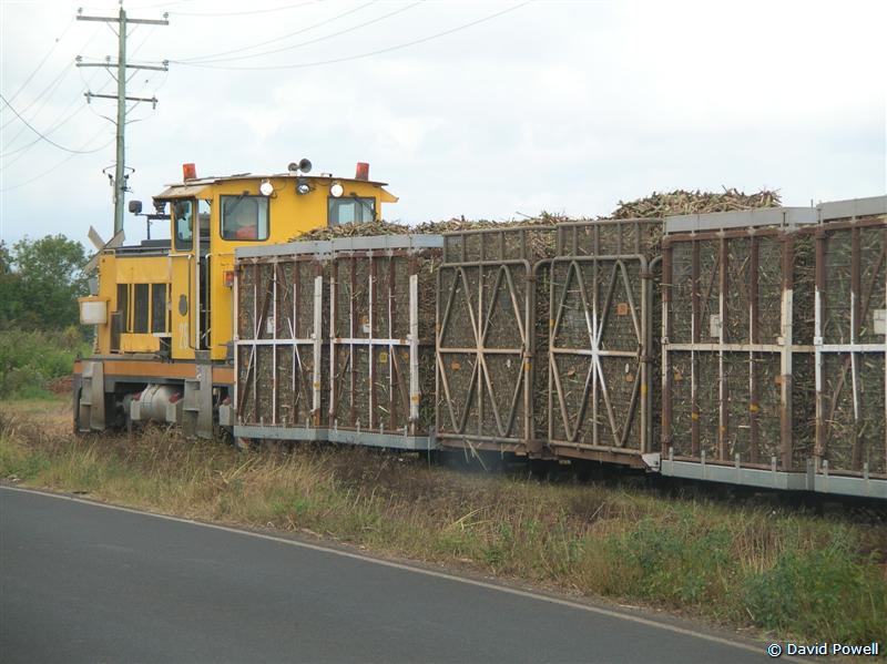
Sugar cane train, South Johnstone,
near Innisfail
Image © David Powell, 2007 |
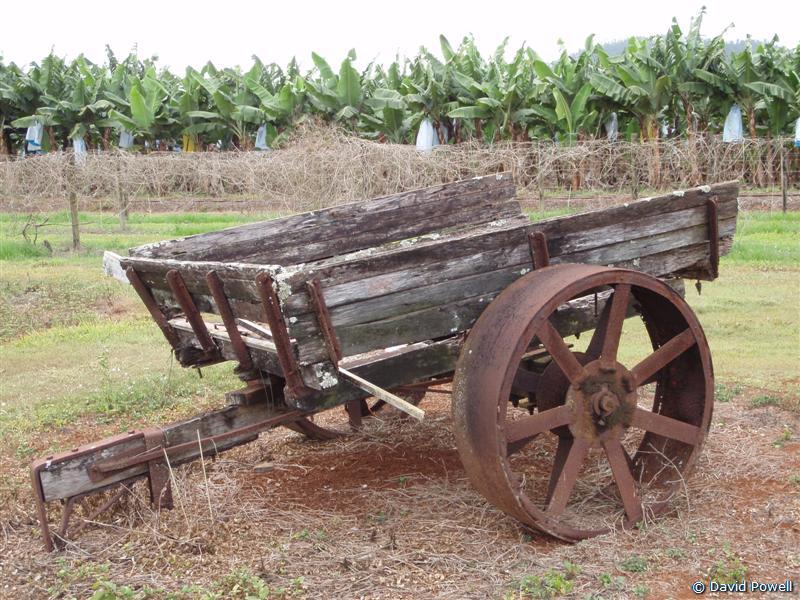
Old cart at a banana plantation,
South Johnstone
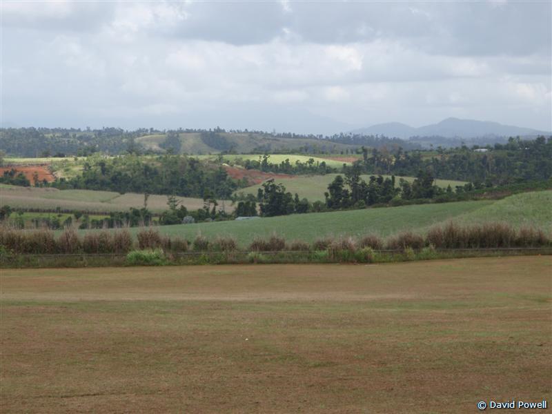
Image © David Powell, 2007 | View across the road, banana plantation
nr South Johnstone
Image © David Powell, 2007 |
|
|
|
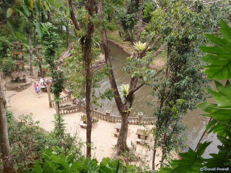
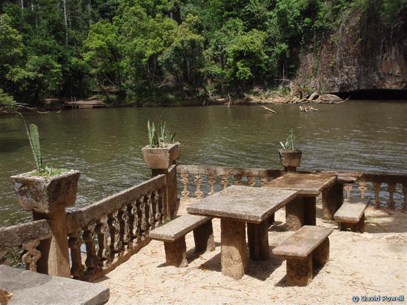
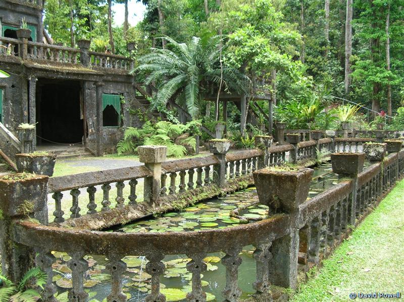
Picnic area & Pool from
'The Castle', Paronella
Image © David Powell, 2007
|
|
|
|
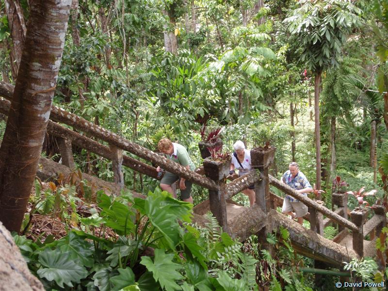
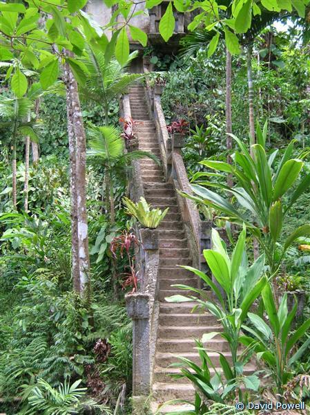
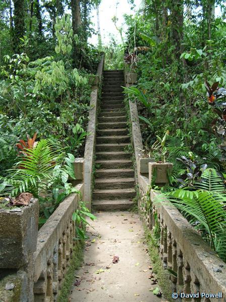
Climbing the Grand Staircase,
Paronella Park
Image © David Powell, 2007
|
|
|
|
Picnic area beside swimming pool,
Paronella Park
Image © David Powell, 2007
|
|
|
|
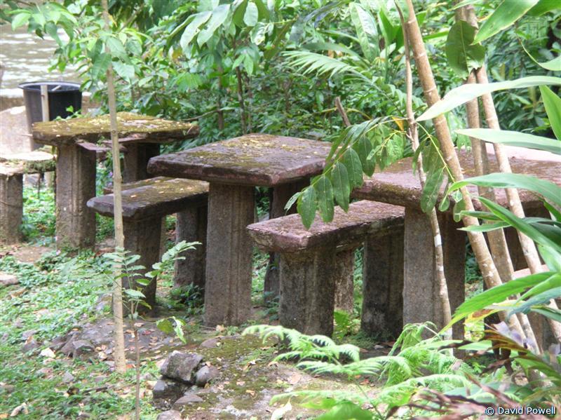
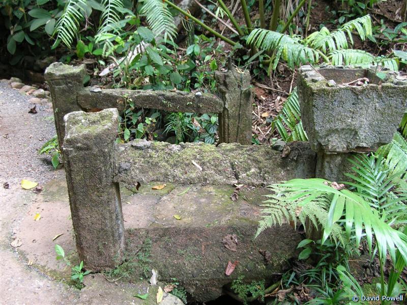
Mossy Picnic tables, Picnic Area,
Paronella Park
Image © David Powell, 2007
|
|
Paronella Park. In the tiny village of Mena Creek are the ruins of a
recreation of a Spanish castle in the middle of a 15 hectare property.
Paronella Park. One of the most recommended things to see from people
who'd been here before. And certainly one of the most advertised with
road-side bill boards .. even north of Cairns over an hours drive away)
you come across the billboards for Paronella. A bit more rain as we
arrived, but that stopped and the tour was dry. We went on the standard
tour - they also have evening and bush tucker tours. The standard one
goes for 45 mins. The guide said "no photos, take them after the tour"
... after the first stop that rule went out the window, tho' she didn't
seem to mind and the tour took no longer. The guide's spiel focused
heavily on the life of Jose Paronella, who's dream created Paronella
Park (hence the tagline "the dream continues"). We'd seen a DVD on the
place before and there was quite clearly a big difference between the
DVD and what we saw (and the reports of other's who'd visited before).
Then it was wet, lush and green. Today ... dry and lots of browns. The
waterfalls were all near ghosts of their full glory. The mosses were
especially affected. Still, it was definitely tropical rainforest, and
the most "junglish" we'd seen so far, for all that it was completely
artificial. The stonework (well concrete) everywhere was covered with
moss, brownish when we visited, but green at other times of the year.
Jose Paronella built the place in the 1920's and 1930's as a dream of
building a Spanish "castle" on the cane fields - he'd made his fortune
in land speculation, buying up near bankrupt cane farms, turning them
around and then selling them .. at a big profit. Enuf of a profit that
he was able to retire and bankroll himself his venture into the tourism
business. Jose built Paronella Park for himself and his family, but he
also built it for the public .. "for a small fee" .. he did everything
"for a small fee". A firm believer in capitalism, Jose was. It opened
to the public in the mid 1930's (1935, I think) and remained so for
decades, well after his death in 1948. It closed in the mid 70's when
his family could no longer operate it. After that the rainforest began
to reclaim what it was once possessed. The carefully cultivated
"jungle" went wild and the buildings started to determinate. Jose built
everything out of concrete he made on the spot from sand and pebbles
from the creek below (he brought in the lime), but for structural
strength, he purloined railway tracks. In the tropical climate
"concrete cancer" became a problem and as the water soaked thru' the
concrete and rusted the iron inside, swathes of concrete fell off,
leading to a rather ruined appearance. Still, most of the structures
are still structurally sound and you can climb the stairs to the upper
floors. The one exception is the ballroom and theatre which was gutted
by fire in 1979. The roof and a lovely wooden floor in the ballroom
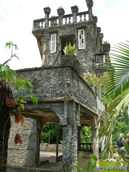
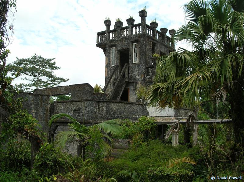
were destroyed along with one of the walls. Now just a shell remains. A
three storey tower at the south end, which housed the theatre's
projection equipment, a small museum etc remains, but is roped off
because of structural instability. Today the wooden floor has been
replaced by pavers and there's even a tree growing on what's left of
the stage. Very much a picture of ruins being reclaimed by the jungle.
Once again, very Hollywoodish, but real. The present owners visited the
abandoned site in the early 1990's, fell in love and bought the
property in 1993. They restored the gardens, repaired or stabilised the
buildings, turned the residence into a museum and offices and revived
Jose's dream of having a Spanish castle in the tropics open to the
public.
|
|
|
|
Refreshment Rooms, Paronella
Image © David Powell, 2007 |
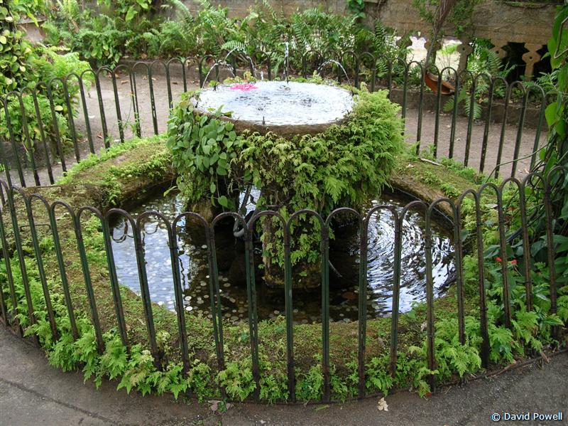
Fountain in front of Refreshment Rooms
Image © David Powell, 2007 | Mena Creek falls thru' Refreshment Rooms
Image © David Powell, 2007 |
|
|
|
|
|
|
Grand Staircase from
Picnic Area, Paronella
Image © David Powell, 2007 |
Lovers Lane,
Paronella Park
Image © David Powell, 2007 |
Bridge & stairs,
Paronella Park
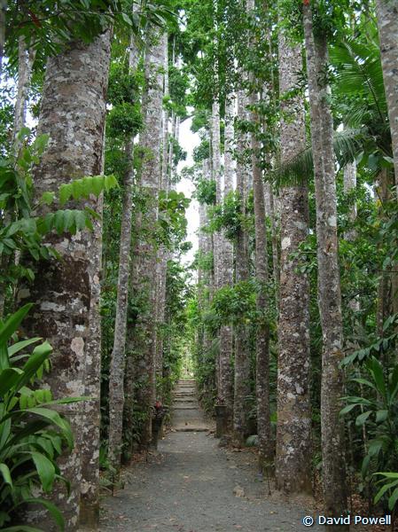
Image © David Powell, 2007 | Kauri Avenue,
Paronella Park
Image © David Powell, 2007 |
Tower, 'The Castle',
Paronella Park
Image © David Powell, 2007 |
|
|
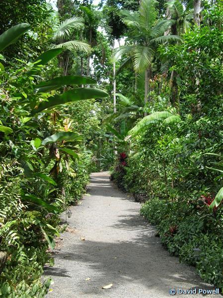
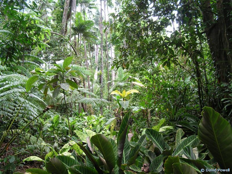
Forest Trail, Paronella Park
Image © David Powell, 2007
|
|
|
|
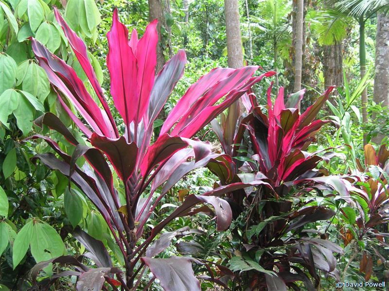
Cordyline fruticosa, Paronella Park
Image © David Powell, 2007
|
|
|
|
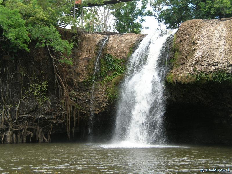
Mina Creek Falls, Picnic Area,
Paronella Park
Image © David Powell, 2007
|
|
|
|
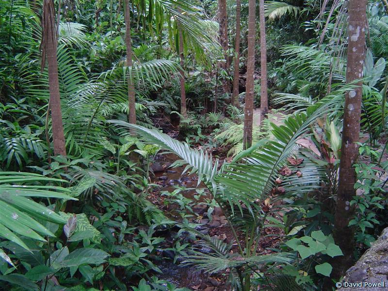
Forest Trail, Paronella Park
Image © David Powell, 2007
|
|
|
|
Teresa Creek, Paronella Park
Image © David Powell, 2007
|
|
|
|
Cynthia & David, Teresa Falls,
Paronella Park
Image © David Powell, 2007
|
|
Saw the ruins of the ballroom and heard tales of the movies, balls,
dances and other activities that Jose hosted, especially during the
days of the depression. Then climbed down the Grand Staircase to the
creek below. The staircase was the first thing Jose built .. so he
could get the sand and gravel for his concrete from the creek below up
to where he wanted to build his castle. The staircase is also,
strangely enuf, in the best state of all of his creations. The
staircase goes down to a landing beside a little lake where Jose
created a picnic area, complete with tables and chairs, all made from
concrete. The western side of the lake is a U-shaped cliff over which
tumbles the Mina Creek - the Mina Creek Falls. Jose had his own private
waterfall. Next to the falls he built a multi-storey hydroelectric
plant to provide electricity for his home and the movie theatre. It was
the first in the state and all the machinery is still there, rusting
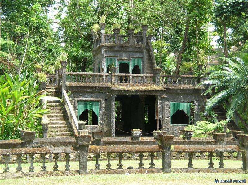
away. The owners are fund raising to do a restoration. Up another
flight of stairs to the change rooms. These were the most elaborate
part of the park. A most fanciful creation. Don't think of your local
beach change rooms ... these are more along the lines of the horse
loving guy who builds extremely expensive and fancy stables and then a
modest dwelling for his family. Three stories. In its day it was a very
popular spot for weddings, with a two year waiting list. Even today, in
its ruined state, it's still popular for weddings (tho' presumably not
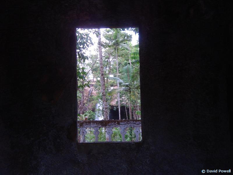
in the traditional heavy wedding gown!). After the tour we climbed to
the top .. there're viewing balconies on each floor. Nice views
overlooking the park. Originally the view west was of the small
lake and waterfall, but that's mostly blocked by trees now. To the east
you look over a formal lawn, complete with a very European fountain and
pond. The fountain still works, mind you, tho' watch out for the horse
flies. They do bite! Jose even built a toilet block just off the side
of the lawn area, again with a second storey viewing platform ... mind
you the steps were all pretty steep. I'd hate to try climbing them in
formal early 20th century garb! The gardens are extensive and full of
paths, streams and lots and lots of bridges, all built with the same
Spanish style as the buildings. Most of the bridges are fully intact.
There's the Tunnel of Love, traveling some distance underground. Jose
originally planned to put fish tanks in the tunnel along with lighting,
but his concrete was too porous (hence the concrete cancer elsewhere)
and he could not put the electrical wiring in. Today it's a dark and
damp tunnel, home to micro bats .. and tourists. Originally courting
couples could walk thru' the tunnel, "for a little price", with a
chaperone of course. For an additional "little price" the chaperone
would meet them at the other end of the tunnel. As I said, Jose was a
capitalist. :) At one end of the tunnel are gardens, at the other
a secluded grove with a little waterfall fed by a spring, full of
ferns, mosses and delicate plants. Quite romantic. With seats ...
sitting three .. the courting couple .. and the chaperone, of course.
Then there're the countless walking trails thru' the rainforest. One
impressive feature was a corridor of 90 year old Kauri Pines,
stretching for several hundred metres in a straight line. The pines are
all at least 30 metres high. Dead straight trunks, stretching up into
the heavens. Plenty of potential telegraph poles there! The bamboo
grove. The turtle ponds. And in much of the water, large fish, up to a
foot long. No flowers this time of the year but lots of highly coloured
cordylines.
|
|
|
|
|
Fountain outside 'The Castle', Paronella
Image © David Powell, 2007 |
The Castle, Paronella Park
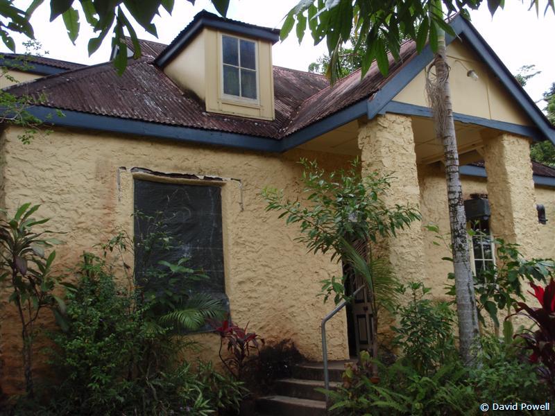
Image © David Powell, 2007 | Original Cottage, Paronella Park
Image © David Powell, 2007 |
Paronella Park is certainly well worth the visit. It's a magical place
of dreams and fantasy and exactly like all those movies where some
European tries to create a home in the tropics that looks like a
European nobleman's residence .. the 18th century style "castle" (not
the stereotype Norman castle, think French and chateau's). The only
difference, this is real, it's not Hollywood. But one bit of advice ...
the best time to visit would be at the start of the dry season .. April
to July. Out of the rain and heat of the wet season, but still lots of
water on the ground, the waterfalls are still full and the vegetation
still retains its wet season vigour. Of course, if the idea of the wet
season doesn't bother you (it's also the cyclone season and Paronella
as been hit quite a few times), then February-March would be the
perfect time to visit. |
|
|
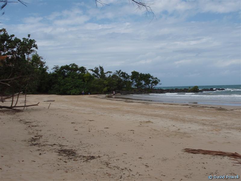
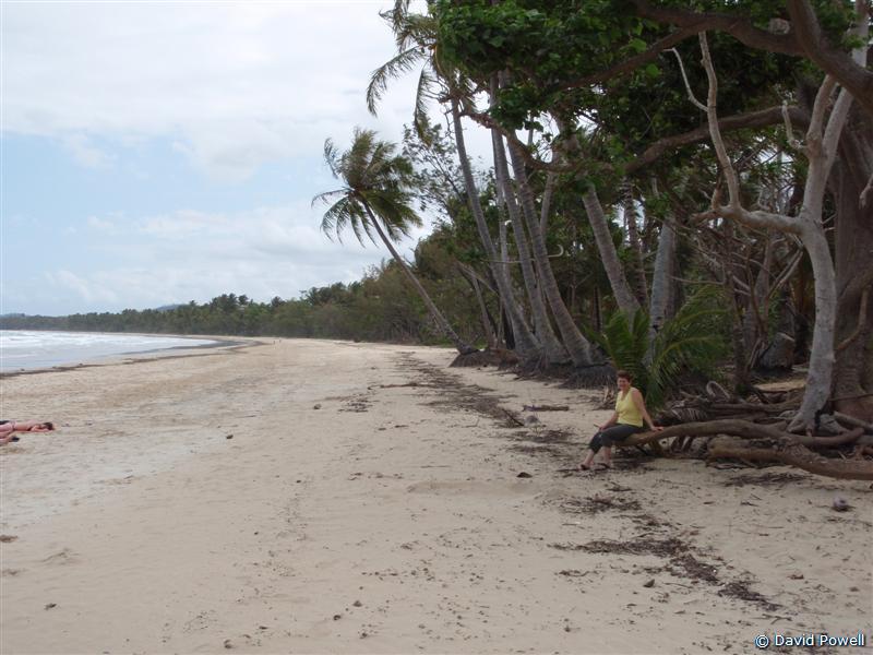
Mission Beach, North view
Image © David Powell, 2007
|
|
|
|
Cynthia & south view, Mission Beach
Image © David Powell, 2007
|
|
|
|
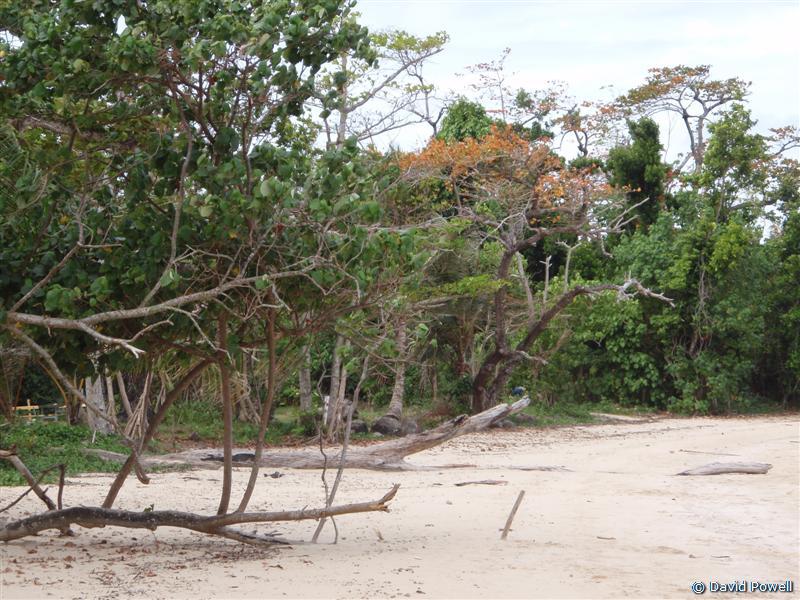
Rainforest, Mission Beach
Image © David Powell, 2007
|
|
|
|
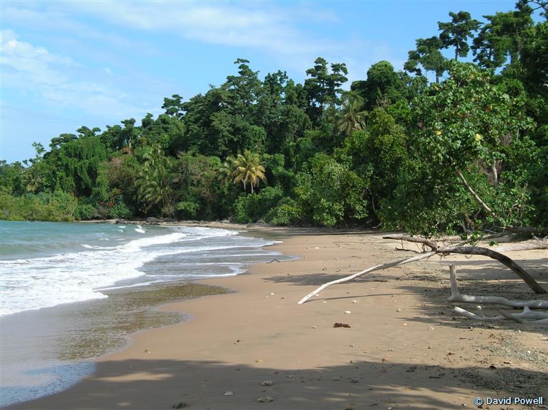
Clump Point, Bingil Bay
Image © David Powell, 2007
|
|
Back on the road. Hoped to catch lunch at Silkwood which had a tourist
info centre according to the map .. if it has that surely it has an
eatery or two? No sign of the info centre and only one closed burger
joint. Oh well, a late lunch. On the road to Kurrimine Beach is the
Murdering Point Winery. No grapes, all their produce is made using
tropical fruits, so the use of the term "winery" is perhaps a bit
misleading. Tasted their range, a mixture of reds, whites and ports ..
some we didn't like, some we both agreed on .. even better they deliver
anywhere in the country - saves running the risk of getting the bottles
broken by the airline luggage handlers doing their usual thing. As for
their name .. in 1878 the "Riser" ran aground on the King Reef and was
broken up by heavy seas. Survivors managed to reach the shore in the
ship's dingy, only to be attacked, murdered and, well, eaten by the
local aborigines. Hopefully that's not suggesting anything about
this wine!
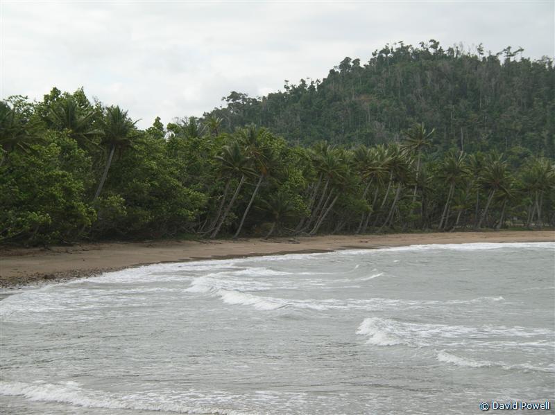
On south to Mission Beach where we had lunch at a Turkish cafe.
Delicious. It seems almost every cafe or restaurant up he is "ethnic".
Still, the area has a very large migrant population and it is very
popular with backpackers .. especially Germans and Japanese. The
Japanese I can understand .. but the Germans? Had a gander at the beach
and took some snaps. Looks much like any other beach in the area I
guess. Yes, every beach is different, just like everyone's fingerprint
is different .. which isn't all that great a difference. :)
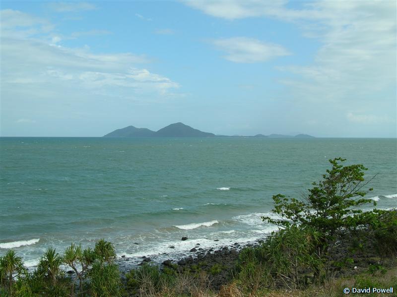
Stopped at two spots with scenic views just to the north of Mission
Beach. Clump Point Jetty with a nice bay and a stretch of beach. Then
to Clump Point itself with great views of nearby Dunk Island - one of
the more famous Barrier Reef Islands. The view was more than a bit
hazy, alas. No cane fields around Mission Beach - it's strictly fishing
and tourism .. a rather narrow slice of land wedged between the ocean
on one side and the Clump Mountain National Park on the other.
Apparently there're quite a few Cassowaries in the area .. signs all
around Mission Beach saying "Beware Cassowaries". Took the scenic
coastal road back to the main highway - got some nice views of Bingil
Bay.
|
|
|
|
|
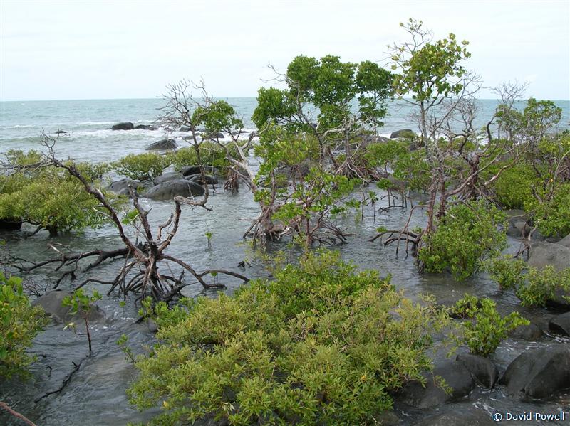
Mangroves, Clump Point, Mission Beach
Image © David Powell, 2007 |
Dunk Island, Clump Point, Mission Beach
Image © David Powell, 2007 | Bingil Bay, Mission Beach
Image © David Powell, 2007 |
The town of Mission Beach is relatively recent, being established in
1939. The area itself tho' had been settled long before, with
plantations all up and down the coast as well as timber-cutting in the
area. The name itself dates back to 1914 when the state government
established an aboriginal settlement at what is now Mission Beach. Even
tho' it was never a mission and the poor residents were dragged there
in chains, the locals referred to it as "The Mission". A name that
stuck, despite the settlement only lasting 4 years before it was
destroyed by a cyclone and abandoned. Nearby Bingil Bay was actually
the site of the first white settlement in the area - Cutten brothers
settled there in 1882, farming mangoes, bananas, pineapples, coffee,
citrus fruit and coconuts. One last note on Mission Beach .. it's home
to The Big Cassowary .. a 5 metre statue of a cassowary. The way things
are going it might soon be the only one left in the region.
|
|
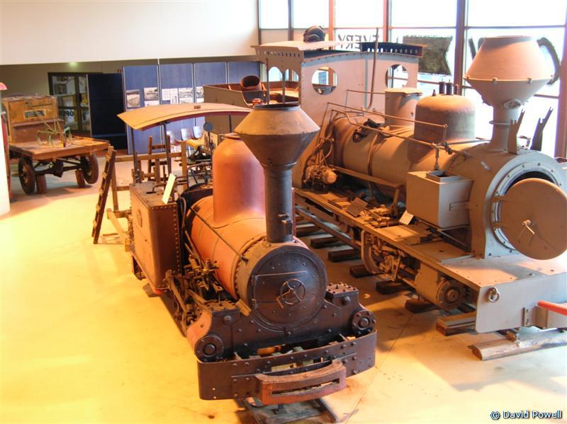
Old Sugar cane steam engines,
Sugar Museum, Mourilyan
Image © David Powell, 2007
|
|
|
|
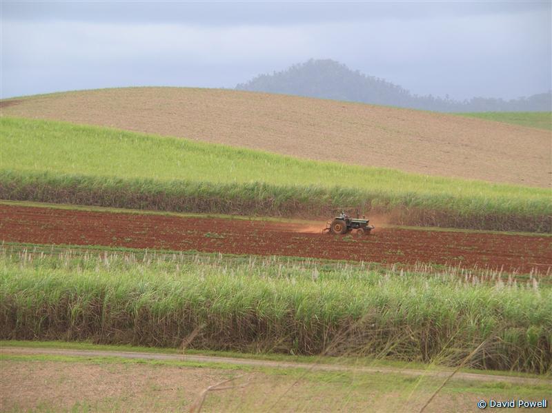
Tractor in cane fields,
near Garradunga
Image © David Powell, 2007
|
|
|
|
Steam-powered tractors,
Sugar Museum, Mourilyan
Image © David Powell, 2007
|
|
|
|
Canefields & misty mountains,
Bartle Frere
Image © David Powell, 2007
|
|
Heading north we passed back thru' Innisfail. Just south of Innisfail
is the town of Mourilyan, which is home to the Australian Sugar Museum,
which opened in 1977. Saw the History of Sugar video and then browsed
thru' the museum - a collection of obsolete equipment associated with
the sugar industry from the earliest days up to the 1970's or so. Part
of a refinery, several sugar train steam engines, a bunch of tractors
dating back to the horse drawn variety .. and one imaginative tractor
built almost all of wood .. apart from the engine. Farming implements.
Scientific equipment used in quality control and even an old 1960's IBM
punched card computer. On the road again .. just north of Innisfail
there was something of a delay. Early in the afternoon a truck carrying
a load of transformers lost his load .. on a straight stretch of road
and scattered along a good 20 metre stretch. Methinks someone didn't
secure their load properly. One fell off and then the rest followed,
domino fashion. The highway was reduced to one lane ... for both
directions .. for several 100 metres. Made use of the opportunity for
some scenic photo's.
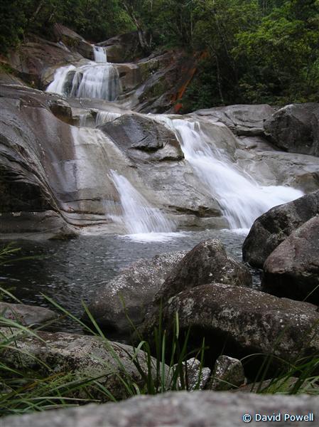
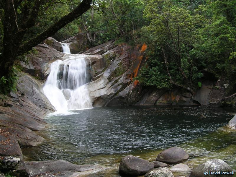
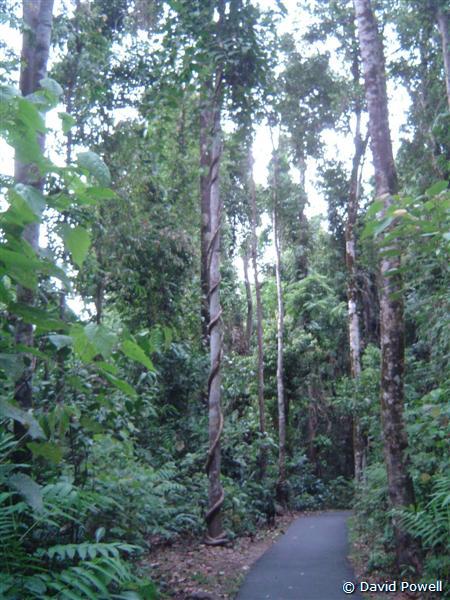
Just when the day's travels looked to be over, we saw a sign - always a
dangerous thing when you are sightseeing. So we took a detour to see
Josephine Falls, about 1/5th the way north between Innisfail and
Cairns. Arriving at the car park it was a 700 metre walk to the falls
thru' lush and wet rainforest .. it'd rained not long before we got
there. Not a single stair .. apart from at the end with some of the
viewing platforms - so a nice leisurely stroll thru' the dripping
rainforest. The falls are more delicate than powerful and the stream
originates from nearby Mount Bartle Frere, the tallest mountain in
Queensland at 1622 metres. For a perhaps obvious reason, the side of
the mountain that gives rise to the stream is called "Broken Nose". The
place is very photogenic and often features on TV shows and
commercials. The area is all part of the Wooroonooran National Park (I
think I got all the o's right!), packed full of walking trails,
spectacular gorges, waterfalls and, of course, rainforest. Lots of
rainforest. Wooroonooran is part of the Wet Tropics World Heritage
Area. The falls didn't have a great volume of water, but didn't appear
visibly diminished like the other's we'd already seen. This one was,
well, simply delicate. Beautiful. Definitely. Well worth the visit for
both the falls and the tropical rainforest walk.
|
|
|
|
|
|
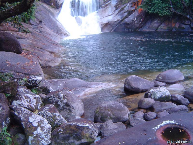
The Falls,
Josephine Falls
Image © David Powell, 2007 |
The Falls, Josephine Falls
Image © David Powell, 2007 |
Rainforest trail,
Josephine Falls
Image © David Powell, 2007 |
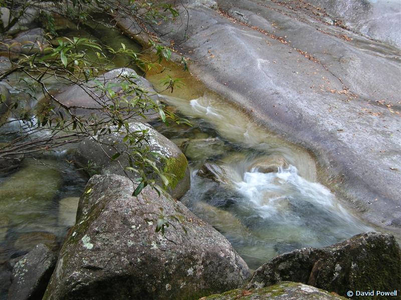
Swirling water, Josephine Falls
Image © David Powell, 2007 |
|
|
|
|
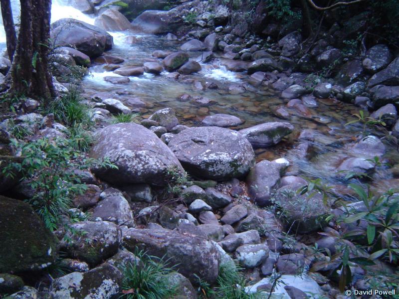
Rocky stream bed, Josephine Falls
Image © David Powell, 2007 |
Rock pool, Josephine Falls
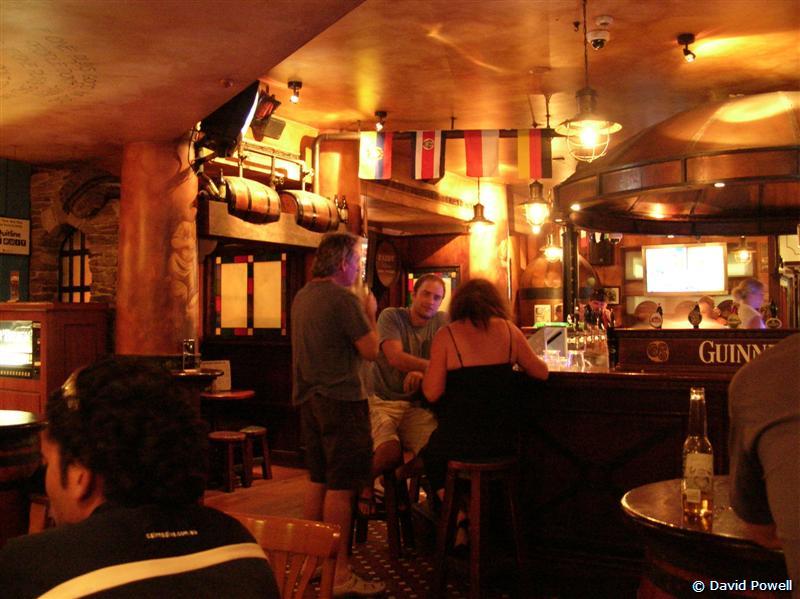
Image © David Powell, 2007 | PJ O'Brien's Irish Pub, Cairns
Image © David Powell, 2007 |
Back onto the main road and onto Cairns .. and just as we hit the main
road, the rains arrived. Not a deluge, but certainly more than a shower
and quite widespread. Mind you, the cloud had been around all day,
especially over the mountains. Plenty if sunshine of course. Still
raining, on and off, by the time we got to Palm Cove. Stopped at Cairns
for dinner at PJ O'Brien's, an Irish Pub (the staff all Irish, of
course) and strolled thru' the Night Market's. Can't say I was
impressed .. pretty junky stuff, strictly aimed at the overseas tourist
market.
|